Drone Technology: An In-Depth Exploration |
Drone technology, also referred to as Unmanned Aerial Vehicles (UAVs) or Unmanned Aerial Systems (UAS), has rapidly evolved in recent years, becoming an indispensable tool across a wide range of industries. In 2024, drones have reached a level of sophistication that incorporates artificial intelligence (AI), autonomous flight capabilities, advanced sensor systems, and more powerful engines, all of which have dramatically improved their effectiveness, reliability, and application in both commercial and industrial fields. In this article, we will explore the current advancements in drone technology, their diverse applications, and the trends driving the future of this rapidly growing industry. |
|
1. Introduction to Drone Technology |
Drones are vehicles capable of flying without a human pilot onboard, typically controlled remotely by an operator or autonomously through pre-programmed flight paths. Initially developed for military purposes, drones have transitioned into civilian uses due to their low cost, versatility, and ability to access hard-to-reach locations. Over the past decade, drones have evolved significantly, with technological innovations in propulsion systems, battery life, camera and sensor capabilities, and AI-driven flight systems. |
The integration of AI and machine learning has particularly fueled drone innovation, allowing these devices to operate with greater autonomy. In 2024, drones are not just tools for aerial photography or recreational use-they are essential components in various industries, transforming logistics, agriculture, construction, energy, and even emergency services. |
|
2. Technological Advancements in Drone Systems |
2.1. AI and Autonomous Flight |
AI is perhaps the most significant advancement in drone technology in recent years. While earlier drones required manual control for navigation and obstacle avoidance, today's drones are increasingly capable of flying autonomously, thanks to AI-driven systems. These systems allow drones to analyze their environment, make real-time decisions, and adapt to changing conditions without human intervention. |
AI in drones is primarily used for: |
Autonomous navigation: Drones can follow pre-programmed flight paths or dynamically adjust their routes based on real-time data, avoiding obstacles and making decisions about the best course of action. |
Obstacle detection and avoidance: Modern drones are equipped with sophisticated sensors, including LiDAR (Light Detection and Ranging), radar, and optical cameras. These systems enable drones to detect objects in their environment, including other aircraft, trees, buildings, and power lines, and take evasive action if necessary. |
Flight stability and control: AI helps to optimize flight stability by continuously adjusting to factors like wind speed and altitude, ensuring smooth and stable flight even in adverse weather conditions. |
Data collection and analysis: Drones are increasingly used for gathering data in fields like agriculture, surveying, and environmental monitoring. AI can process and analyze this data in real time, providing actionable insights for decision-making. |
The result is a new generation of drones capable of fully autonomous operations with minimal human oversight, making them safer, more reliable, and more efficient. |
2.2. Enhanced Sensors and Camera Technology |
Another area of significant improvement is in the sensors and cameras onboard drones. Advances in optical and infrared technology have vastly improved the resolution and quality of images and video captured by drones. These enhanced imaging capabilities are particularly important in industries like construction, agriculture, and infrastructure inspection. |
High-resolution cameras: Drones are now equipped with ultra-high-definition cameras capable of capturing 4K and even 8K video. This is particularly useful for aerial surveys, inspections, and cinematography, where high-quality visual data is crucial. |
Infrared and thermal imaging: Drones equipped with thermal sensors can detect heat signatures, which is invaluable for tasks like search and rescue, firefighting, or identifying energy inefficiencies in buildings. Thermal cameras can also be used for wildlife monitoring or identifying heat leaks in industrial sites. |
LiDAR technology: LiDAR (Light Detection and Ranging) is a remote sensing technology that uses laser pulses to measure distances and create highly accurate 3D maps of the terrain. This is a game-changer for surveying and mapping, as it allows drones to capture detailed topographical data in real time. LiDAR is used in applications ranging from forestry management to urban planning. |
2.3. Battery Life and Power Systems |
One of the early limitations of drones was their short battery life, which restricted their ability to operate for long periods or cover large areas. However, as battery technology has improved, drones are now able to fly longer distances and stay airborne for extended periods. |
Lithium polymer (LiPo) batteries: The most common type of battery used in drones today is the lithium polymer (LiPo) battery, which offers high energy density and relatively fast charging times. These batteries are lighter and more compact, providing the power necessary for longer flights. |
Battery management systems (BMS): Modern drones incorporate sophisticated battery management systems that optimize the performance of the battery, ensuring that drones can fly for longer periods without risking a power failure. These systems monitor the battery's health and regulate power distribution to prevent overheating or overcharging. |
Solar-powered drones: Some drones are experimenting with solar technology to extend flight times. These drones use solar panels to recharge their batteries during flight, making them ideal for long-duration applications like environmental monitoring or surveillance. |
Despite these advancements, battery life remains a challenge for certain applications. The quest for more efficient energy sources, such as hydrogen fuel cells or more advanced battery chemistries, continues to drive research in drone technology. |
2.4. Increased Payload Capacity |
The payload capacity of drones has also significantly increased, enabling them to carry heavier equipment and perform more complex tasks. Modern drones can carry payloads ranging from small cameras to large industrial sensors or delivery packages weighing several kilograms. |
Industrial drones: These drones are used for applications like crop spraying, heavy-lifting in construction, or carrying medical supplies to remote areas. They are built with more powerful motors and reinforced frames, which allow them to carry and deliver larger payloads. |
Package delivery: The increasing payload capacity of drones has paved the way for commercial package delivery services. Companies like Amazon and UPS have begun testing drone delivery systems, which could revolutionize logistics by reducing delivery times and costs. These drones can carry small to medium-sized packages and deliver them directly to consumers, bypassing road traffic and reducing congestion. |
In 2024, drones are becoming capable of transporting heavier and more diverse payloads, making them indispensable for industries that require precision and efficiency in their operations. |
|
3. Key Applications of Drone Technology |
Drones are being used in a variety of industries, where they provide solutions to long-standing problems and open up new possibilities for innovation and efficiency. |
3.1. Logistics and Supply Chain |
The logistics and supply chain industry is one of the biggest beneficiaries of drone technology. Drones are transforming the way goods are delivered, reducing costs, and increasing speed. |
Parcel delivery: Drones can deliver small packages directly to consumers, eliminating the need for trucks and reducing delivery times. This is particularly beneficial in rural or hard-to-reach areas where traditional delivery methods are slow and costly. |
Inventory management: In warehouses, drones are used for inventory tracking and stock management. Equipped with RFID scanners and cameras, drones can autonomously scan shelves, track stock levels, and even move goods around the warehouse without human intervention. |
The growth of drone delivery services is expected to expand as more companies invest in this technology. Drone deliveries can cut down on carbon emissions, reduce traffic congestion, and lower costs by bypassing traditional road-based transportation. |
3.2. Agriculture |
Agriculture is another area where drones have proven to be a game-changer. Drones are used for everything from crop monitoring to pesticide application, allowing farmers to optimize their operations and reduce costs. |
Crop monitoring: Drones equipped with high-resolution cameras and thermal sensors can monitor crop health by detecting issues like nutrient deficiencies, pest infestations, or water stress. This allows farmers to take targeted actions rather than applying treatments across entire fields, saving time and resources. |
Precision spraying: Drones are used to spray fertilizers, pesticides, and herbicides in a more efficient and environmentally friendly manner. By using drones, farmers can apply these substances with greater precision, reducing waste and minimizing environmental impact. |
Drones also provide valuable data for precision agriculture, helping farmers optimize irrigation, planting, and harvesting schedules to maximize yield and reduce costs. |
3.3. Infrastructure Inspection |
Drones are widely used for infrastructure inspection, replacing traditional methods that require scaffolding, cranes, or expensive helicopters. Drones can inspect bridges, power lines, wind turbines, and communication towers quickly, safely, and cost-effectively. |
Bridge and building inspection: Drones are equipped with high-resolution cameras and sensors that allow inspectors to assess the condition of infrastructure without having to climb or use expensive equipment. This makes inspections safer and more efficient, especially for hard-to-reach or dangerous locations. |
Power line and wind turbine inspection: Drones can fly along power lines or inspect wind turbine blades, detecting damage or wear and tear that may require maintenance. They can also be equipped with thermal sensors to detect overheating or faults in electrical systems. |
In 2024, the use of drones for infrastructure inspection is becoming commonplace, reducing the risks and costs associated with traditional methods while improving accuracy. |
3.4. Search and Rescue |
Drones have proven to be invaluable tools in search and rescue operations. Their ability to reach remote areas and operate in difficult conditions makes them ideal for locating missing persons or providing assistance in disaster-stricken regions. |
SAR operations: Drones equipped with thermal imaging cameras and GPS systems can quickly search large areas for heat signatures, making them ideal for finding lost hikers, detecting survivors in rubble after natural disasters, or locating missing persons in vast, inaccessible terrains. |
Delivery of supplies: Drones can also deliver critical supplies, such as first-aid kits, food, or water, to people in emergency situations, especially when ground access is limited. |
Drones are revolutionizing how rescue teams operate, making their missions faster and more efficient while reducing risk to human personnel. |
|
4. Challenges and Future Directions |
Despite their many advantages, drone technology faces several challenges that must be addressed to unlock its full potential. |
4.1. Regulation and Airspace Management |
As drone usage continues to grow, managing airspace to avoid conflicts with manned aircraft has become a major issue. Governments and aviation authorities are developing regulations to ensure safe integration of drones into airspace, particularly in urban environments. |
Traffic management: Advanced systems for drone traffic management (UTM, or Unmanned Traffic Management) are being developed to ensure that drones can fly safely alongside other aircraft. These systems will help to prevent collisions and ensure compliance with airspace restrictions. |
Privacy concerns: Drones equipped with high-resolution cameras raise privacy concerns. Governments are establishing guidelines for drone usage to ensure that operators respect privacy laws and regulations. |
4.2. Battery Life and Range |
While drone battery life has improved, it still limits their capabilities in certain applications. Longer battery life is essential for tasks that require drones to operate over long distances or for extended periods. |
Energy efficiency: Advances in energy-efficient motors and better battery chemistry are expected to improve drone flight times, making them more capable of handling long-duration missions without frequent recharging. |
4.3. AI and Safety |
AI-driven autonomous drones present a potential risk if they malfunction or make poor decisions. Ensuring the safety and reliability of autonomous drones is crucial to their widespread adoption. |
Safety protocols: Advances in AI will continue to focus on improving decision-making, collision avoidance, and failure recovery systems to ensure that drones can safely operate in complex environments. |

|
5. Conclusion |
Drone technology has advanced dramatically in the past decade, making drones versatile tools in various industries, from logistics and agriculture to construction and emergency response. The integration of AI, improved sensors, enhanced battery life, and greater payload capacities has revolutionized the capabilities of drones. As the technology continues to evolve, drones are expected to play an even larger role in transforming industries and improving the efficiency of operations across the globe. |
However, challenges remain, particularly in the areas of regulation, safety, and battery efficiency. With ongoing research and development, the future of drone technology looks incredibly promising, offering endless opportunities for innovation and growth. |
|
What new technologies will be related to this in the future? |
As drone technology continues to evolve, several new technologies are expected to be integrated into drones, enhancing their capabilities and expanding their potential applications across industries. Here are some of the key emerging technologies that will be related to drones in the future: |
1. 5G Connectivity and Edge Computing |
1.1. 5G for Faster Data Transmission |
5G technology is poised to revolutionize drone operations, particularly for real-time data transmission and long-range control. Unlike 4G, which can sometimes struggle with high latency or limited bandwidth, 5G promises ultra-low latency (as low as 1 millisecond), extremely high data transfer rates, and the ability to support a large number of devices simultaneously. |
Real-Time Video Streaming: 5G will enable drones to stream high-definition or 4K video in real time to control centers or end-users. This will be particularly useful for industries such as surveillance, infrastructure inspection, and search-and-rescue operations, where real-time decision-making is critical. |
Remote Operations: With 5G, drones can be operated from much greater distances, far beyond the line of sight, as the reduced latency and improved data speeds will allow for more reliable remote piloting and autonomous operations. |
1.2. Edge Computing for On-Board Processing |
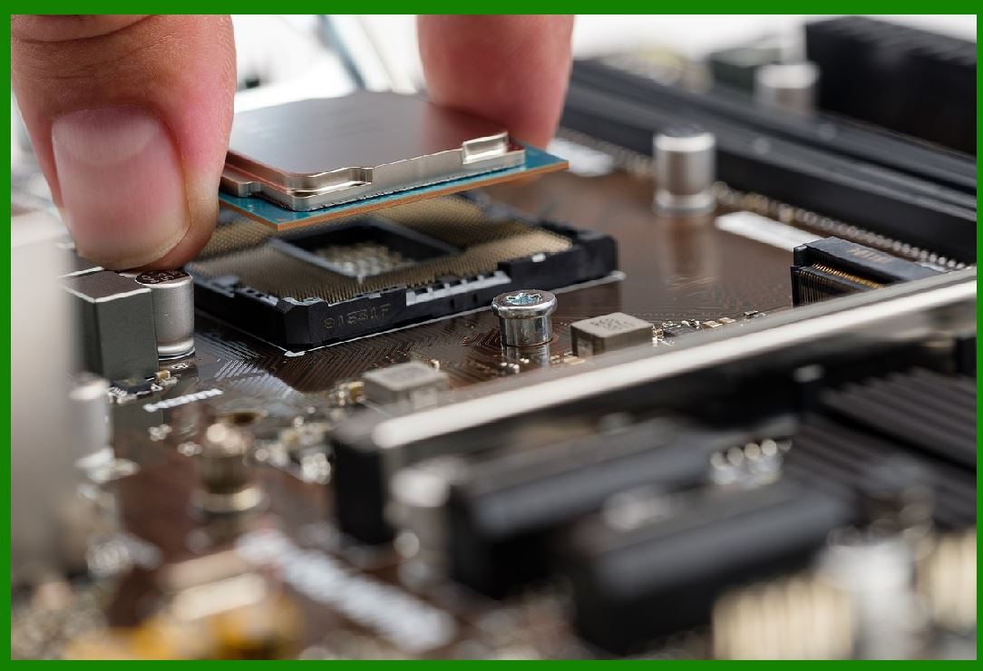
Edge computing involves processing data locally on the drone itself, instead of sending all data to a centralized cloud for processing. This is particularly important for drones that need to make real-time decisions, like obstacle avoidance or environmental monitoring. |
Improved Autonomous Flight: By leveraging edge computing, drones can analyze sensor data on the fly, improving their decision-making capabilities. This is essential for autonomous drones that operate in complex or dynamic environments, such as delivery drones navigating urban areas or agricultural drones monitoring crop conditions. |
Reduced Latency: With edge computing, drones can process data faster, resulting in less reliance on cloud servers and reducing the delays typically associated with transmitting large amounts of data over the internet. |
|
2. Quantum Computing |
While quantum computing is still in its early stages, it holds great potential for enhancing drone technology in the long term, especially in areas such as data analysis, AI, and autonomous navigation. |
2.1. Advanced Machine Learning Models |
Quantum computers have the ability to solve complex problems much faster than classical computers. For drones, this could mean improvements in AI models that require heavy computation, such as real-time image recognition or machine learning-based decision-making. |
Better AI Algorithms: Quantum computing could drastically accelerate the training and execution of AI algorithms that power drones, allowing for more sophisticated and efficient autonomous behavior. |
Optimization: Drones often need to solve complex optimization problems, such as the most efficient flight path or the best strategy for resource allocation. Quantum computing could help solve these problems more effectively. |
2.2. Enhanced Sensor Fusion |
Quantum computing might also enhance the ability of drones to fuse data from multiple sensors (such as LiDAR, cameras, and radar) to create more accurate models of the environment, improving navigation and decision-making. |
|
3. Battery and Energy Technologies |
The limitations of battery life are one of the biggest challenges for drones, but several emerging energy technologies could address this issue in the coming years. |
3.1. Solid-State Batteries |
Solid-state batteries are an emerging alternative to the traditional lithium-ion batteries used in drones. These batteries use a solid electrolyte rather than a liquid one, which makes them more stable, longer-lasting, and capable of holding more energy. |
Increased Flight Time: Solid-state batteries could significantly extend drone flight times, potentially allowing drones to operate for hours rather than minutes, opening up new possibilities for long-duration missions. |
Safety and Reliability: Solid-state batteries are safer than lithium-ion batteries, as they are less prone to catching fire or exploding when damaged, making them more reliable for commercial use. |
3.2. Solar-Powered Drones |
Solar energy is already being explored as a way to extend the flight time of drones, especially for applications like environmental monitoring, where long endurance is required. |
Continuous Flight: Solar-powered drones could stay in the air for extended periods by harvesting solar energy during flight. This is especially useful for tasks like surveillance, scientific research, or remote sensing. |
Integration with AI: AI can optimize the energy usage of solar drones, adjusting flight paths or operations based on available sunlight and energy requirements. |
3.3. Hydrogen Fuel Cells |
Hydrogen fuel cells are another potential solution to improve the energy efficiency and flight time of drones. Fuel cells are highly efficient and produce fewer emissions than traditional combustion engines or lithium batteries. |
Longer Range: Hydrogen fuel cells could enable drones to fly for much longer distances than current battery technology allows. This could be especially useful for industrial applications that require long-range travel, like infrastructure inspection or delivery services. |
Sustainability: Hydrogen fuel cells produce only water vapor as a byproduct, making them a more environmentally friendly option compared to lithium-ion batteries, which pose recycling challenges. |

|
4. Swarming Technology and Collaborative Drones |
Swarming technology involves the coordination of multiple drones that work together as a group, much like a flock of birds or a school of fish. This technology, powered by AI and communication protocols, is expected to have a major impact on drone operations in the future. |
4.1. Autonomous Drone Fleets |
Swarming technology will enable drones to operate in fleets that can autonomously collaborate to complete complex tasks, such as large-scale inspections, environmental monitoring, or delivery services. |
Scalability: By enabling multiple drones to work together seamlessly, it will be possible to scale up operations. For example, a fleet of drones could be used to deliver packages across a city or perform a large agricultural survey more efficiently than a single drone could. |
Task Specialization: Each drone in a swarm can be programmed to perform different tasks based on its capabilities. Some might focus on navigation, while others focus on data collection, making the entire system more efficient. |
4.2. Collaborative AI and Communication |
For drone swarms to function effectively, they must be able to communicate with one another in real time. This requires advancements in communication protocols and AI algorithms that allow drones to share data, adjust their flight paths, and make collective decisions. |
Real-Time Coordination: AI-driven communication networks will allow drones to cooperate and adjust to changes in their environment, such as avoiding obstacles or re-routing in response to weather conditions or other obstacles. |
|
5. Advanced Sensors for Enhanced Perception |
The development of new, more sophisticated sensors will continue to push the boundaries of drone capabilities, making them more useful for tasks that require precise data collection in complex environments. |
5.1. Hyperspectral Imaging |
Hyperspectral imaging goes beyond the visible spectrum, capturing data across a wide range of wavelengths. This could be used in agriculture, environmental monitoring, and mining to detect subtle changes in vegetation, land composition, or chemical properties. |
Precision Agriculture: Drones equipped with hyperspectral cameras can detect specific crop diseases, nutrient deficiencies, or even soil composition at an unprecedented level of detail. |
Environmental Monitoring: Hyperspectral sensors could be used for tracking pollutants or monitoring biodiversity in ecosystems, providing scientists with a richer set of data for conservation efforts. |
5.2. Radar and LiDAR Integration |
Future drones may feature integrated radar and LiDAR sensors, which would combine the strengths of both technologies-LiDAR's high-resolution 3D mapping capabilities and radar's ability to detect objects in poor visibility or extreme weather conditions. |
Improved Obstacle Avoidance: LiDAR can help detect and map objects with high precision, while radar can help identify obstacles in low-visibility conditions, making drones safer to operate in a wider range of environments. |
|
6. Regulatory and Air Traffic Management Technologies |
As drones become more integrated into airspace, managing their movement and ensuring their safe operation alongside manned aircraft will be essential. The development of air traffic management (ATM) systems tailored for drones is already underway, and these systems will be crucial for ensuring that drones can be deployed at scale. |
6.1. UAM (Urban Air Mobility) |
Urban Air Mobility involves the use of drones and other aerial vehicles for transporting people and goods within cities. This technology will require highly sophisticated air traffic management systems to coordinate flights, manage congestion, and ensure safety. |
Integration with Manned Aircraft: In cities where drones and traditional aircraft share the same airspace, advanced systems will be needed to prevent collisions and manage air traffic. |
AI-Driven Traffic Control: Future air traffic control systems will rely heavily on AI to manage the movement of drones and other autonomous aerial vehicles, ensuring safe and efficient travel through urban environments. |
6.2. Geofencing and No-Fly Zones |
Geofencing technology allows drones to autonomously avoid restricted areas, such as airports, military zones, or no-fly zones. As drone usage becomes more widespread, enhanced geofencing technology will be essential to ensure drones do not fly into restricted or dangerous areas. |
Real-Time Geofencing: Geofencing technology will become more dynamic, adjusting in real-time to changing airspace restrictions or temporary no-fly zones, ensuring drones adhere to regulatory boundaries. |
|
Conclusion |
The future of drone technology will be shaped by a combination of innovations in energy, AI, connectivity, and sensing technologies. From the deployment of autonomous drone fleets and swarming technology to the advent of long-duration, solar-powered, or hydrogen-fueled drones, these advancements will continue to open new possibilities for drone applications across industries. |
As drones become more intelligent, efficient, and integrated into everyday operations, their role in society will only expand, revolutionizing fields like logistics, agriculture, construction, and emergency response. However, alongside these advancements, regulatory frameworks, safety standards, and ethical considerations will need to evolve to ensure that drones can be deployed safely and responsibly in our airspace and communities. |
|
Case Studies of Drone Technology in Various Industries |
The growing sophistication of drone technology has led to its adoption across many industries. Below are a few case studies highlighting how drones are being utilized in diverse fields, showcasing their transformative potential and the challenges associated with their integration. |
1. Agriculture: Precision Farming with Drones |
Case Study: DJI's Agricultural Drones for Crop Monitoring |
Overview: |
In agriculture, drones are transforming the way farmers monitor and manage crops. Drones equipped with high-resolution cameras, thermal sensors, and multispectral sensors can gather data that provides actionable insights into crop health, soil conditions, and pest infestations. DJI, one of the leading drone manufacturers, has been at the forefront of introducing agricultural drones designed to support precision farming. |
Technology Used: |
Multispectral Imaging: Used for capturing images across different wavelengths to monitor crop health. |
Thermal Sensors: Detect areas of water stress, pest infestations, or nutrient deficiencies. |
AI and Data Analytics: AI tools process the data captured by drones, providing real-time insights for farmers. |
Impact: |
Improved Crop Health Monitoring: Farmers can now monitor their crops with greater detail and accuracy, detecting problems that would have been missed using traditional methods. For example, drones can identify specific areas of a field with pest damage, allowing farmers to apply pesticides only where needed, reducing pesticide use and costs. |
Increased Yields: By using drones for precise crop management, farmers have been able to optimize irrigation, apply fertilizers more effectively, and reduce water consumption. This results in higher yields and more sustainable farming practices. |
Cost Savings: Precision farming allows farmers to reduce input costs by targeting interventions (fertilization, irrigation, pest control) more efficiently. In some cases, farmers report savings of up to 30% in operational costs. |
Challenges: |
Data Interpretation: The data collected by drones requires careful analysis and interpretation, often requiring specialized knowledge or software. The integration of AI has alleviated some of these challenges, but human expertise is still essential for making actionable decisions based on drone data. |
Initial Investment: While drones can lead to cost savings, the initial cost of drones and software can be a barrier for small-scale farmers. |
Conclusion: |
DJI's agricultural drones have revolutionized the way farmers manage their fields. By integrating drone technology with AI-driven data analytics, the company has made precision agriculture accessible and beneficial, helping farmers increase efficiency, sustainability, and profitability. |
|
2. Logistics and Supply Chain: Drone Delivery in E-Commerce |
Case Study: Amazon Prime Air - Drone Delivery Service |
Overview: |
Amazon Prime Air is a drone delivery service launched by Amazon with the goal of delivering packages to customers within 30 minutes of ordering. The service utilizes autonomous drones equipped with AI, sensors, and GPS to transport small parcels weighing up to 5 pounds, making them ideal for fast delivery of small e-commerce orders. |
Technology Used: |
Autonomous Navigation: Drones use GPS and AI to navigate urban and rural environments safely and efficiently. |
Obstacle Avoidance: Equipped with a combination of vision sensors and LiDAR, drones are able to detect and avoid obstacles like trees, buildings, and power lines. |
AI and Machine Learning: Drones are able to analyze their environment, make real-time decisions, and adjust flight paths to avoid potential hazards. |
Impact: |
Faster Deliveries: Amazon Prime Air promises to reduce delivery times significantly, offering 30-minute or less delivery windows. This is a major leap forward in e-commerce logistics, particularly for customers who need fast delivery of small, everyday items. |
Reduced Costs: Drone deliveries can reduce reliance on traditional delivery vehicles, lowering transportation costs and reducing the company's carbon footprint. |
Increased Scalability: The integration of drones into Amazon's supply chain allows for rapid scaling, particularly for deliveries in dense urban areas or hard-to-reach locations. |
Challenges: |
Regulatory Hurdles: One of the primary challenges faced by Amazon Prime Air is obtaining regulatory approval for widespread drone operations, especially in populated areas. In the U.S., the FAA has strict guidelines regarding drone airspace usage, which has delayed full-scale implementation. |
Airspace Management: As drone deliveries become more common, managing airspace to avoid collisions with manned aircraft becomes an increasing concern. This will require the development of robust air traffic management systems tailored for drones. |
Conclusion: |
Amazon Prime Air represents a significant step forward in transforming the logistics and delivery industry through drone technology. While regulatory and operational challenges remain, the potential for faster and more cost-effective deliveries could revolutionize e-commerce. |
|
3. Infrastructure Inspection: Drone-Based Inspections for Energy Infrastructure |
Case Study: BP - Drone Inspections for Oil Rig Platforms |
Overview: |
BP, a global energy company, uses drones to inspect offshore oil rigs and other energy infrastructure in hazardous or hard-to-reach environments. Traditionally, these inspections required workers to climb high structures or use helicopters, both of which are time-consuming, dangerous, and expensive. Drones have revolutionized this process by offering a safer and more efficient alternative. |
Technology Used: |
LiDAR and Thermal Imaging: Drones equipped with LiDAR sensors provide detailed 3D maps of oil rigs, while thermal imaging sensors identify heat anomalies that could indicate potential equipment failure or safety hazards. |
AI for Predictive Maintenance: Drones capture real-time data during their flights, and AI algorithms analyze this data to predict when maintenance is required or when a piece of equipment is likely to fail. |
Impact: |
Increased Safety: By replacing dangerous manned inspections with drone inspections, BP has significantly reduced the risk to workers. Drones can also inspect equipment in extreme weather conditions, where human safety could be at risk. |
Faster Inspections: Drone-based inspections take a fraction of the time compared to traditional methods. This is particularly important for minimizing downtime and ensuring the continuous operation of offshore platforms. |
Cost Reduction: Drone inspections are far more cost-effective than the traditional methods, especially when considering the reduced need for scaffolding, helicopters, and personnel. |
Challenges: |
Data Accuracy: Ensuring that drones capture high-quality, accurate data for analysis is crucial. While drone technology has advanced, interpreting complex datasets, such as LiDAR and thermal imagery, still requires specialized expertise. |
Battery Life and Payload Capacity: While drones have improved in these areas, there are still limitations on flight time and the weight of sensors that can be carried, especially for long-duration offshore inspections. |
Conclusion: |
BP's use of drones for offshore oil rig inspections has improved safety, efficiency, and cost-effectiveness. As drone technology continues to improve, it is likely that more energy companies will adopt this technology to streamline their inspection processes. |
|
4. Search and Rescue: Drones in Emergency Response |
Case Study: DJI's Drones in Disaster Response after Hurricane Maria |
Overview: |
In 2017, Hurricane Maria devastated Puerto Rico, and drones played a crucial role in providing emergency responders with the information they needed to coordinate rescue operations. DJI, a global leader in drone manufacturing, sent drones equipped with high-resolution cameras and thermal sensors to the island to help locate survivors and assess damage. |
Technology Used: |
Thermal Imaging: Drones equipped with thermal cameras were used to search for survivors in areas where traditional rescue methods were impossible due to flooding, debris, or other obstacles. |
High-Resolution Cameras: Drones captured aerial images of devastated areas, helping responders assess infrastructure damage and prioritize areas that needed immediate attention. |
Real-Time Data Sharing: Drones transmitted live video feeds to first responders and command centers, enabling more informed decision-making during rescue operations. |
Impact: |
Faster Search and Rescue: Drones helped responders locate survivors in the aftermath of the hurricane, significantly speeding up the search process. Thermal drones, in particular, were instrumental in locating people trapped under debris or stranded in difficult-to-reach locations. |
Infrastructure Assessment: The aerial imagery captured by drones helped emergency responders identify which areas had suffered the most damage, allowing them to allocate resources more effectively. |
Improved Communication: Drones provided real-time data to rescue teams, ensuring that the right decisions were made during the recovery process. |
Challenges: |
Communication Infrastructure: After the hurricane, Puerto Rico's communication infrastructure was severely damaged, limiting the ability of drones to transmit real-time data. While satellite communication helped bridge the gap, establishing reliable communication in disaster zones remains a challenge. |
Weather Conditions: Drones are limited by adverse weather conditions such as high winds and heavy rain, which can impair their ability to operate effectively in disaster zones. |
Conclusion: |
DJI's drones played a critical role in the disaster response efforts following Hurricane Maria, showcasing the potential of drone technology in search-and-rescue missions. With further advancements in drone durability, communication systems, and AI-driven search algorithms, drones will continue to be an invaluable tool in emergency response. |
|
5. Environmental Monitoring: Drones for Conservation and Wildlife Protection |
Case Study: World Wildlife Fund (WWF) - Drones for Anti-Poaching Efforts in Africa |
Overview: |
The World Wildlife Fund (WWF) has been using drones to combat poaching in Africa, where endangered species like rhinos, elephants, and tigers face constant threats. Drones are used to monitor wildlife populations, track poaching activities, and even prevent illegal hunting by providing real-time data to park rangers. |
Technology Used: |
Thermal Imaging: Drones equipped with thermal sensors are used to detect poachers at night, when illegal hunting activities are most common. |
AI and Machine Learning: AI is used to analyze drone footage and detect patterns in poaching behavior, enabling rangers to take proactive measures. |
Geospatial Mapping: Drones create detailed maps of wildlife habitats, allowing conservationists to track animal movements and identify potential threats. |
Impact: |
Improved Surveillance: Drones provide constant aerial surveillance, enabling park rangers to monitor vast and remote areas that would be otherwise impossible to patrol effectively on foot. |
Prevention of Poaching: By using drones to monitor areas where poaching is most prevalent, rangers can respond more quickly to incidents, preventing poaching and protecting endangered species. |
Cost-Effective Conservation: Drones have significantly reduced the cost of conservation efforts by reducing the need for manned patrols, which can be expensive and labor-intensive. |
Challenges: |
Privacy and Legal Concerns: The use of drones in wildlife monitoring raises privacy and legal concerns, particularly around surveillance of indigenous communities living near protected areas. |
Drone Maintenance: Operating drones in remote areas requires ongoing maintenance and troubleshooting, which can be challenging in harsh environments. |
Conclusion: |
Drones have become an essential tool in the fight against poaching and for the conservation of endangered species in Africa. The WWF's use of drone technology has not only improved surveillance and response times but has also made wildlife protection efforts more cost-effective and sustainable. |
|
Conclusion |
The case studies above demonstrate the wide-ranging applications of drone technology across various sectors, from agriculture and logistics to emergency response and environmental conservation. As drone technology continues to advance, it is likely that drones will become even more integrated into everyday operations, offering greater efficiency, safety, and cost-effectiveness. However, challenges related to regulation, privacy, and operational efficiency must continue to be addressed to fully realize the potential of drones across these industries. |
 cs@easiersoft.com